Synopsis
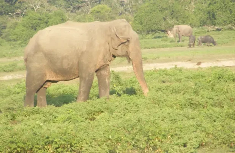
This article unveils an internationally significant story. It quantifies how the species per unit area in Sri Lanka is unexpectedly anything from 5 to 13 times higher for certain species groups, than predicted by island bio geography in comparison to other large tropical islands such as Borneo, New Guinea and Madagascar. Sri Lanka is a puzzle: it has large animals which a moderately sized island should not have. In fact it has the highest annually recurring concentration of wild elephants and possibly the highest density of leopards. Unusually for a continental island, large whales are close to shore (best for Blue Whale and super-pods of Sperm Whales). This article is the first to provide a cohesive explanation in plain English as to how planetary physics, evolutionary forces and human factors have worked, almost as if with a design to create a wildlife super-rich island; arguably the best all-round wildlife watching destination.
Introduction
This is the story of how evolutionary forces and ancient civilizations have made a tropical island super-rich for wildlife on a scale that is not seen anywhere on moderately sized or large islands. Sri Lankaa??s super-richness on a proportionate scale eclipses large islands such as Madagascar, Borneo and New Guinea.
Alfred Russell Wallace, the founder of modern bio geography and Charles Darwin with whom he shared the theory of natural selection in evolution were both influenced by what they had observed on islands. Both of them would have been surprised by Sri Lanka. Almost every key driver of evolution seems to have played a part in shaping its biodiversity. The result is an island which is rich in wildlife both in terms of endemic tropical biodiversity as well as large land animals and marine mammals and in concentrations which give rise to some of the worlda??s most interesting wildlife spectacles. Ita??s an island which Wallace and Darwin or modern biologists could not have imagined as so many of the bio geographical and evolutionary forces have come in to play simultaneously, to create an unrivaled richness. To top it all, ita??s a compact country with good tourism infrastructure making it optimal for wildlife tour operators.
This article is about the physical, evolutionary, and human factors that have made Sri Lanka something seemingly imaginary, but yet real.
In a previous article (Sunday Times: Sri Lanka, 13 January 2013) I explained why Sri Lanka has a claim to be the best all-round wildlife destination from a wildlife tour operatora??s perspective. In this article I explain the physical, evolutionary and human-induced forces that have made this happen. In essence, I would simplify it conceptually into a three part a??business modela?? for the creation of a top wildlife destination. The first is a set of physical factors, especially those influencing both surface and underwater topography. These together with other planetary phenomena such as plate tectonics and monsoons create structural or topographical complexity on land and under water. Together with time, the topographical or structural complexity on land with monsoonal rainfall has led to the creation of distinct climatic (and hence ecological) zones that are the engine for specialization. Sri Lanka has benefited from other physical factors such as an ancient Gondwana start and having deep seas close to it unlike other continental islands. Having set up the right conditions for evolutionary factors, the engine of speciation needs to be fed with raw material. The output of the species production factory will be enhanced if besides the operation of long intervals of evolutionary time scales, new species production is boosted by fresh stocks of mainland species through immigrant waves. However, surprisingly, Sri Lanka has managed to produce a phenomenally above normal species richness (explained below with examples) primarily from evolutionary radiations within the island resulting in endemic genera and species. It seems that only later has it supplemented its cargo of species by land-bridging repeatedly with the mainland. This has become more apparent recently through phylogenetic studies using DNA.
I would describe the land-bridging as a five stage process for building up the number of species. During periods of glaciations, water is deposited as ice on land and sea levels fall forming a land bridge in the shallow seas. A land bridge is still physically evident in the discontinuous land bridge between Mannar and India, known as Adama??s Bridge. New waves of immigrants are imported to the island via the land bridge and dispersed and then isolated by rising sea levels drowning the land bridge during warming after an ice age (a post glacial). The new arrivals are physically stressed into niches by complex structural and physical factors of topography and climate. In essence, the process is connect a?? import and disperse a?? isolate a?? stress a?? speciate.
Glaciations have been a key agent of the islanda??s richness in allowing large land mammals to colonise and persist in Sri Lanka. However, phylogenetic studies indicate that most of the radiations of endemic species occurred before the land bridge connections of the Pleistocene epoch in the Quaternary Period. So land-bridging has helped, but still unresolved evolutionary forces have been responsible for the species super-richness which occurred before the recent Pleistocene ice age.
The third of the large scale factors is that it has benefitted from human factors or a cultural overlay. The last has two aspects. Firstly, the decline of ancient kingdoms has resulted in great seasonal gatherings of wild elephants and one of the best sites for leopards. This creates wildlife spectacles which make great viewing on wildlife safaris. (These spectacles have also been complemented by evolutionary factors mentioned above resulting in species radiations which are of great scientific interest even though species such as amphibians are not high on the list of commercial wildlife safaris). The second aspect of the cultural overlay is that the deep respect for life makes wildlife viewing easy as man and animals co-exist with great tolerance.
Taking Stock: What does Sri Lanka have?
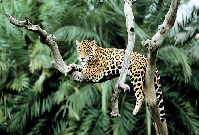
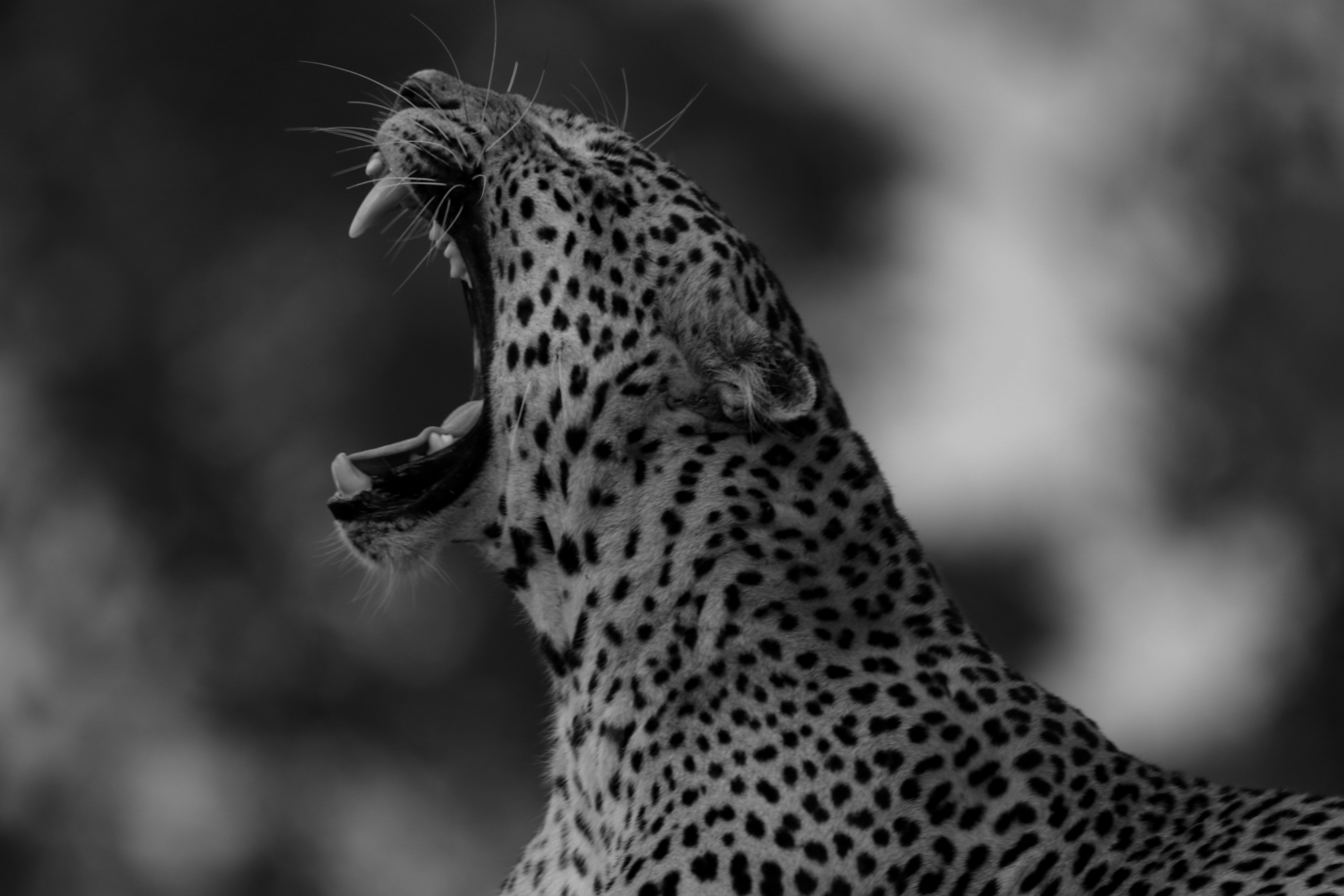
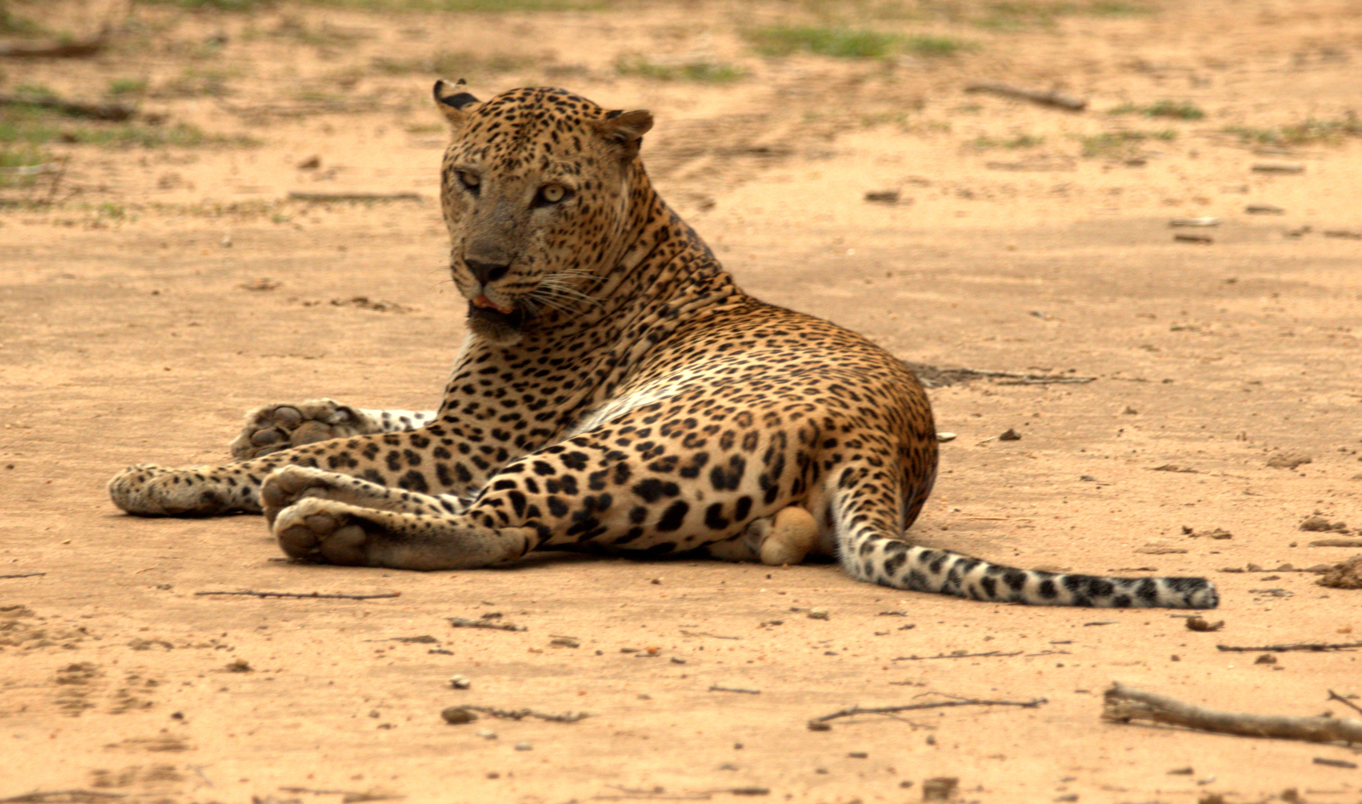
Allow me to start by surprising you. If I asked you which country has the largest seasonally recurring gathering of elephants, what would your answer be? You might think it is somewhere in Africa. And if I asked you for an easy and reliable location to see Blue Whales, the largest animals to have lived on Earth and once one of the hardest animals to see, what would it be? Or consider super-pods of Sperm Whales, the largest toothed carnivore. Is there a country where there is a chance of seeing one on a commercial whale watch? Or one of the best to photograph leopards or the Sloth Bear (possibly the largest tropical bear)? The surprise is that the answer to all of these is the same country; Sri Lanka. This is both impressive and surprising given that it is in contradiction to conventional island biogeography according to which a moderately sized island (65,610sq. km.) is unlikely to have large terrestrial animals.
Sri Lankaa??s potential to be the best for big game safaris outside Africa (albeit on a different and smaller scale) is only now beginning to be discovered by wildlife photographers from both within and outside the island.
All-right, I hear you say; top marks for the big stuff. But what about biodiversity? Well, let me surprise you again and illustrate it with a recent statistic. First remember that it is well established that the larger the land area, the larger the number of species will be (the species-area relationship). Of course we also need to compare land areas from similar latitudes because species richness increases as one travels from high latitudes to the tropics. Leta??s take inland snakes for example. Sri Lanka has 89 species in approximately 66,000sq. km. How much more would you estimate that other tropical islands which are approximately between nine to twelve times bigger will have?
The numbers are surprising: New Guinea (86 species in 786,000sq. km.), Madagascar (91 species in 578,000sq. km.) and Borneo (141 species in 734,000sq. km.). One would have expected these islands to have ten times as many species. But none manages even twice as much and the extent which Sri Lanka is above the species-area curve is conspicuous even if you factor in that more species are to be discovered in the bigger islands. The relative species per unit area is extraordinary and is repeated with many species groups.
So why is Sri Lanka off the curve?
Clearly there is something remarkable and special going on with the forces of speciation, about which the island has still received little international publicity, although that will change when wildlife film producers pay it more attention.
For many vertebrate species, Sri Lanka ranks high in terms of species per unit area. Leta??s take a closer look at one vertebrate example where this may not seem to be the case. Costa Rica is synonymous with amphibians. With a land area of 51,000sq. km. it is fifteen per cent smaller than Sri Lanka and has more amphibian species; 199 versus the 120 from Sri Lanka. So is Sri Lanka not special with amphibians? Although Costa Rica is smaller as a political unit, it benefits from being part of the large physical unit of South America. Therefore in a wider sense the species-area still holds as it has benefitted from being a part of the vast South American continent. A better comparison for Sri Lanka would be a similar sized or larger island which is a natural bio-geographical entity. For example, Madagascar, which is nine times bigger, has only two and a half times as many amphibian species.
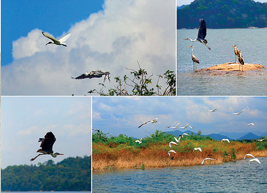
After mammals, birds are the most a??touristya?? of animals. Sri Lanka has 33 species of endemic birds, largely confined to its lowland and highland wet zones. The number of endemic birds per unit area is high compared to Borneo (52 species) and Madagascar (106 species with a 51% endemism rate), but on par with New Guinea (320 species). A further fifty plus species of birds found in Sri Lanka are shared only with India (subcontinental endemics). Furthermore, it has a special avian spectacle in the Sinharaja Bird Wave. This is the longest continuously studied mixed species bird flock phenomenon in the world, with the largest average number of individuals in a flock from such studies and offers the most stable viewing of usually fast moving tropical bird waves. The island is the last stop on the Central Asian flyway and a million migrant shorebirds were counted one February in a land based census which suggests that Viddathalthivu in the Mannar region may even be the most important integral site for migrants on the Central Asian flyway. The shorebirds make landfall in Sri Lanka funnelling through the once powerful ancient seaport of Mannar through to the Palatupana Salterns and Bundala National Park in the South: the latter two offer some of the best close viewing of waders in the world.
As explained earlier, a three factor a??business modela?? has been at work to create this extraordinary richness and I will expand on this in the sections to follow.
Creating the perfect, super-rich wildlife destination
Imagine your goal was to create the perfect location for wildlife tourism. Sri Lanka would be a good example of how to go about it. You want to keep it small so that tourists dona??t have to travel too far from one location to another. But not too small as small areas dona??t have many animals and also cannot hold on to their animals. An island would be good as isolation allows species to evolve into new species. An ancient start would help. So leta??s begin with Sri Lanka being split off from ancient Southern Gondwana, tethered to India and drifting north on the Indian tectonic plate, carrying an ancient cargo of species which results in affinities between species in Madagascar and Sri Lanka. Next, crash the Indian plate into the Asian land mass (creating the Himalayas) and allowing Palaearctic mammals such as the tiger to drift south into India. Anchor Sri Lanka nearby as a continental island to enable immigration of species from the Asian mainland. But leave the island isolated for sufficiently long interglacial periods (where sea levels rise cutting off the island) for the process of speciation to allow endemics to evolve.
Isolation and physical stresses have resulted in high levels of endemism (e.g. 100% freshwater crabs, 95% amphibians, 80% land molluscs, 53% freshwater-obligate fish, 52% of dragonflies, 25% flowering plants, etc.).These have been supplemented by the a??immigrantsa?? from later land bridge connections. The down-side of repeat connections is that Sri Lanka does not have as high a proportion of endemic species or a number of endemic families as found on an island such as Madagascar.
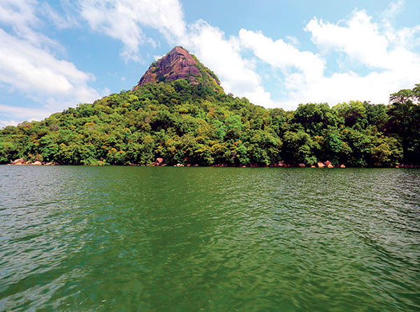
Physical isolation is not enough and ecological isolation is also desirable, both from Asia and within the island. A good trick here is to create a central mountainous core, with two alternating and diagonally blowing monsoons (the Southwest and North-east) creating a very moist a??wet zonea??, distinct from a a??dry zonea??. The mountains also allow for a further vertical zonation, allowing more speciation to take place as some species diverge into sister species at different altitudes. Horton Plains National Park, the roof of Sri Lanka has many species confined to the highlands.
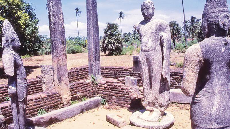
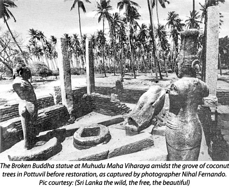
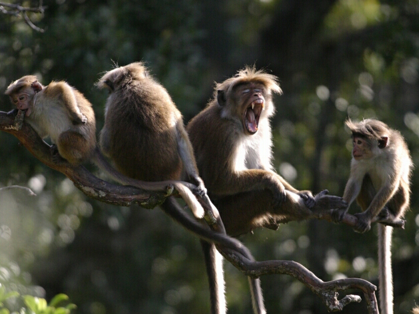
Build on this theme by up-thrusting a few more rugged, spectacular mountain ranges such as the Knuckles Wilderness creating elevated wet zone a??islands a??within the wet zone.This creates point endemics such as the Tennenta??s Leaf-nosed Lizard in the Knuckles. For extra measure add a few mountainous edges to lowland rainforests like Sinharaja to create more point endemics like Karua??s and Erdelena??s Dragon-lizards in Eastern Sinharaja (15 of the 18 agamid or dragon-lizards are endemic). Indulge in more innovation by throwing up a mountain with a wet zone character; Ritigala, surrounded by a sea of dry zone with more point endemics and build a legend around it that it was a piece of medicinal herb rich mountain from the Himalayas dropped by the Monkey God Hanuman as told in the Indian epic of Ramayana. Culture and wildlife go hand in hand in this area of ancient kingdoms of Anuradhapura and Polonnaruwa, where the tallest archaeological brick buildings in the whole world; giant stupas, stand. Endemic Toque Monkeys wage ferocious tribal wars watched over by meditating saffron robed monks and are studied in one of the longest running zoological field studies in the world; the Smithsonian Primate Research project.
The process of speciation can be accelerated further by throwing in a few evolutionary tricks like direct development in the Rhacophorid Tree Frogs. This allows them to skip the stage of laying eggs in water and having tadpoles developing in water which leaves them vulnerable to periods when ephemeral bodies of water dry out. Instead, allow them to use foam nests in which the eggs develop into little frogs which plop out fully formed allowing one of the significant species radiations discovered in the 20th century to take place. There are many other examples of species radiations; for example all 20 of the forestdamsels described so far from the island are endemic. In fact Sri Lanka has four, five, and six times as many species of dragonflies per unit area than New Guinea, Borneo and Madagascar respectively. Geological turmoil and variations in the climate creating a??ecological nichesa?? could also have created physical stresses that favoured evolutionary variation. In fact, although I have referred to Sri Lankaa??s land area as 66,000 sq. km., most of the endemism is packed into an area of around 15,000 sq. km. ; less than a quarter of the total in what comprises the wet zone. This a??localisationa?? of small-range endemic species makes the endemicity (e.g. 740 endemic flowering plants in the wet zone) and the species richness in the wet zone even more remarkable.
Whilst all this is happening, keep stirring the evolutionary brew with fresh material. A few judiciously spaced out glaciations will lower sea levels forming a land bridge (Adama??s Bridge linking India to Mannar across the Palk Strait) allowing mainland species to immigrate and start anew to evolve into new species. Wildlife tourists like big stuff, so keep the land bridge open to get a good population in of the elephants, leopards and Sloth Bears. Ooops! Closed it too soon as enough tigers did not make it across to establish a viable population.
Having got the big stuff in, one may as well make an eco-tourism spectacle out of it. This requires some human intervention or anthropogenic factors for the technically minded. Throw in a liberal sprinkling of ancient kings who will usher a golden age of hydraulic civilisation. They will dot the islanda??s dry zone with grand civil engineering works, with vast lakes (e.g. the Sea of Parakrama) irrigating agriculture. Allow this to go to ruin and perfect conditions are made for the Elephant Gathering at Kaudulla and Minneriya in the North-Central Province where over 300 elephants may gather on the receding lakes in search of grazing, water, mates and social networking (elephants dona??t use Facebook)! Allow the farmland in the South-East in Yala to turn to grassland where together with the man-made waterholes, conditions are perfect for high densities of Spotted Deer, in turn creating one of the highest densities of leopards. The over 2,000 man-made lakes or wewas create wildlife rich wetlands which pre-date the interventionist conservation efforts of the London Wetland Centre. In Yala at Buttuwa Wewa, this results in the largest seasonal concentration in the world of the Mugger or Freshwater Crocodile, the second largest land reptile in the world. Not far away, the soft sandy beaches are visited by five of the seven species of marine turtle including the Leatherback; a giant!
Introduce Buddhism and Hinduism, two great world religions with a respect for animal life. Most animals lose their fear of people and everything from leopards in Yala, Blue and Sperm Whales in the surrounding oceans to fighting Purple Swamphens in Talangama Wetland (close to the commercial capital Colombo) are embarrassingly curious and camera friendly for tourists.
With the top side sorted out, the marine side needs some attention as well. The trick here is to have deep water close to shore which suits the large whales (unlike an island like Britain which is covered with shallow seas or the islands of the Indonesian archipelago).
Improve on this by having the continental shelf pinching in at the South at Dondra Head near the fishery harbour of Mirissa so that Blue Whales can be seen easily close to shore on a morning whale watch from a coastline studded with luxury villas, boutique hotels and backpacker crash pads. Create a deep 400m depth isobath running north-south for Sperm Whales in Kalpitiya (the Sperm Whale Strip of E 79 35 to E 79 40). Slide a peninsula of golden sandy beaches out onto it so that the Sperm Whales are a mere fifteen minutes by boat. For those for whom boats are not their thing, thrust a deep submarine canyon into Trincomalee in the North-East so that Blue and Sperm Whales can be seen from ashore on some days from the temple atop Swami Rock or very rarely from the pool side of beach hotels. For extra good measure throw in a few more canyons on the east coast which are good for enigmatic and elusive beaked whales. All of this is being a bit greedy as the island also has shallow seas where it needs it most; close to the mainland, to allow intermittent land connections for the immigrant waves to supplement the speciation factory.
The island has the best of everything in terms of underwater topography; now add to this a generous mix of nutrients. Whales need food; lots of it. The two monsoons are in charge of the kitchen, driving a hundred and three river systems (yes, thata??s right, 103) bringing down rich organic nutrients from the mountains, slow released from the lichen cloaked cloud forests to the lowlands creating nutrient rich soup around the island. The Blue Whales and the Cloud Forests are inter-connected. Not content with that, whip up some speed with the monsoons and create upwellings, which generate phytoplankton blooms which show up on Indian remote sensing satellites suspended in space in geo-synchronous orbits. All of this food creates fringing coral reefs which are rich in marine species.
Sri Lankaa??s coastline which is 432km long has approximately 800 species of marine fish recorded. Sites better publicised for their marine wildlife such as the 1,126km long Gulf of California (Sea of Cortez) has 700 species of fish. The Maldivian islands which stretch across 1,500km have around 1,200 species recorded and the Great Barrier Reef stretching over 2,600km has 1,500 species. If we consider the number of marine fish species per unit length, we can see that Sri Lanka has roughly treble the statistic for the Gulf of California and double that for the Maldives. This is a very crude measure but it helps to give a flavour to the layperson of the relative species richness. The nutrient rich water in Sri Lanka and the monsoons which lash the shores reduce visibility in the water.
The lack of good viewing has resulted in its species richness not being understood as almost everyone including dive operators in Sri Lanka think the waters are a??poora?? for fish compared to other tropical destinations. I have come to realise that a??poor viewinga?? has been confused with a??poor species richnessa??, which it is not.
To be clear about context, for big game safaris many countries in Africa are unmatched. Large tropical islands such as Madagascar and New Guinea, lack large land mammal herbivores such as elephants or large carnivores such as leopards (Borneo does not have leopards and the origin of its elephants is disputed) but in absolute terms of species, have huge biodiversity. However, from the viewpoint of commercial wildlife tourism, in terms of ease of access, tourism infrastructure, affordability and with a short time frame of say two weeks, there is no country which has the array of terrestrial big game, endemism-rich species density, spectacular marine wildlife, diverse landscapes and close-knit cultural bonds (love-hate with elephants) with wildlife that is found in Sri Lanka.
The proof of the pudding of the physical, evolutionary and human factors is in the viewing. A visit of mine in April 2012 is an example of good evidence. I had an amazing trip where in the space of two weeks I watched courting Blue Whales, scrumming Sperm Whales, had a mother and baby elephant pad silently past my vehicle and drove back to camp in the gathering dusk, passing leopards out on the hunt.
In this article, I have with some speculation on my part drawn together material that is known from Sri Lanka and the mechanics of large scale processes studied elsewhere. Science is dynamic and what is known and conjectured today can change. But the broad principles should hold true and I hope I have explained why Sri Lanka deserves more attention from both those viewing wildlife for pleasure as well as those studying how planetary forces and time, drive the great engine of evolution and biogeographical distributions. At this point I should add a gentle reminder that in reality evolution is a a??blind processa?? although I have for the purpose of telling a story, written it as if evolution had set out to make a super-rich wildlife destination.
I have to add that although it is arguably the best all-round country for multi-faceted wildlife viewing with ease, it comes with a caveat.
Sri Lanka does need improvement in terms of better interpretation and better facilities for visitors at parks and reserves and more responsible guiding. Finally and alarmingly, less than 8% of its biodiversity rich wet zone remains forested and more attention is needed both locally and internationally to lay emphasis on how special this island is for its wildlife.
Island Magic: A summary of how Planetary Physics, Evolution and Ancient Cultures forged a super-rich wildlife destination
- Physical Factors
Continental Island – Permitted intermittent land connection with mainland allowing immigrant waves (see below). Also continental islands usually inherit a rich stock of species unlike oceanic islands created from volcanic activity.
Origin – Benefits from an ancient stock of species which have become island endemics but shows affinities to groups as far away as in Madagascar.
Two diagonally blowing monsoons and a central mountain range – Highly distinct and extreme climatic zones found more typically on large continental masses.
Isolation – Despite the intermittent land connections and proximity to the mainland, the creation of a climatically distinct wet zone, allowed speciation to operate in the manner it does in isolated environments.
Mountain ranges – The central mountains together with the monsoons have created a topographical and climatic complexity, driving evolutionary forces to create more species. Some mountain ranges have a??point endemicsa?? and they create pockets of isolation all over the island.
Deep seas close to shore and shallow seas with mainland. Best of both. – Sri Lanka violates the rule about continental islands having shallow seas around them by having deep seas and submarine canyons (except where it needs shallow seas the most, near the mainland to form intermittent land bridges). The deep seas create conditions for Blue Whales and Sperm Whales to be very close to shore, within sight of naked eye at times.
River Systems – The 103 river systems drain a vast flow of organic nutrients into the deep seas around the island. Per unit length of distance, the coral reefs have more species than more famous marine reserves such as the Gulf of California and the Great Barrier Reef. But rich nutrient load and silt results in poorer visibility than other dive destinations.
Indinavir buy
- Evolutionary factors
Intermittent land bridge connections to mainland – Allowed successive immigrant waves from mainland to boost the number of species in the island and to a lesser extent supply a speciation factory with new material. Later colonisers if successful may evolve into new species if they penetrated a??pockets of isolationa?? in the wet zones. Sri Lanka breaks the rule that moderately sized or small islands dona??t have large animals thanks to the intermittent land bridge.
Species Radiations – For example, rainforest tree frogs in the genus Philautus have evolved direct development, skipping egg laying and tadpoles in the water allowing them to radiate into new species. Other groups such as the Shadowdamsels have all 20 plus species endemic to the island. Evolutionary forces have resulted in Sri Lanka breaking the species-area relationship for islands. Land bridges may have played a part, although present evidence is that it has been a small influence.
- Human factors
Ancient Civilisations and Religion – The Elephant Gathering and the high density of Leopards in Yala are both results of intense agricultural farming. A religious respect for other living beings means Blue Whales and Sperm Whales swim up to boats. Birds and other animals are prolific and tame.
- Result
Wildlife spectacles, high proportion of endemism, large number of species, large animals and easy viewing Sri Lanka is the best in world for some of the most charismatic or desired species (e.g. Blue Whale a??largest animal, Sperm Whale super-pods a?? largest toothed carnivore) or has special spectacles (e.g. the largest recurring elephant gathering, the Sinharaja Bird Wave, high density of Leopards) all in a compact island with good tourism infrastructure and good specialist guides.
Ice Ages and Speciation
The table below summarises a 5 stage process in which a continental island like Sri Lanka would have benefitted by ice ages in enhancing species diversity. This assumes that ice ages acted to lower sea levels in the tropics but did not cover the land with ice sheets as it did in temperate latitudes with islands like Britain. If an island is covered with ice sheets, it will kill species and leave it poor. Britain for example has only 35 species of trees which are native. On the other hand a tropical island like Sri Lanka which was not covered in ice would benefit from a two way exchange of species with the mainland. The dry zone has benefitted from this connection and has species which are found in Southern India and in the northern half of Sri Lanka. The island also has large land mammals such as the elephant and large carnivores such as the leopard not typically found on moderately sized islands.
Puzzlingly and inconveniently, the phylogenetic studies on plants and animals suggest that radiation of species in Sri Lanka took place in the Tertiary age before the series of ice ages in the Pleistocene Epoch (in the Quaternary Period) with the last land bridge connection being as recent as 10,000 years ago. This poses two questions. Firstly, we see that evolutionary events happened in Sri Lanka so many millions of years ago that have left it richer in species compared to much larger tropical islands. New Guinea and Borneo also have varied topographies and have the structural complexity and physical stresses that Sri Lanka has.
If evolutionary events happen because of physical factors combining with random mutations in genes, why has the species per unit area not remained proportionate? Secondly, during the recent ice ages in the Quaternary Period, did the wet zone remain isolated from the Indian mainland surrounded by a sea of dry zone? For answers to the latter question more work will need to be done on the fossil record on plant pollen to understand the extent of different types of forest on the island. The five stage process I have outlined below is a useful general model, but based on what is known at present does not provide the evolutionary answers for Sri Lanka being super-rich in species. This is still a puzzle.
How ice ages could drive a 5 stage speciation process
- Connect
- Import
- Isolate and Disperse
- Stress
- Speciate
Repeat to enhance species richness
Bibliography
Ashton, P. S., Gunatilleke, C. V. S. (1987). New light on the plant geography of Ceylon. I. Historical plant geography. Journal of Biogeography 14: 249a??285.
Bedjanic, M., Conniff, K., van der Poorten, N. & Salamun, A. (2014). Dragonfly fauna of Sri Lanka: distribution and biology, with threat status of its endemics. Pensoft, Sofia. 321 pp.
Bambaradeniya, C.N.B. (Editor), (2006). The Fauna of Sri Lanka: Status of Taxonomy, Research and Conservation. The World Conservation Union, Colombo Sri Lanka & Government of Sri Lanka. viii + 308 pages.
Bossuyt, F., Meegaskumbura, M., Beenaerts, N., Gower, D., Pethiyagoda, R., Roelants, K., Mannaert, A., Wilson, M., Bahir, M., Manamendra-Arachchi, K., Ng, P. K. L., Schneider, C., Oommen, O. V. & Milinkovitch, M. C. (2004). Local endemism within the Western Ghats-Sri Lanka biodiversity hotspot. Science., Volume 306. 479-481.
Dennis, R.L.H. (1977). British Butterflies. Their Origin and Establishment. E.W.Classey Ltd: Oxon.
Donnelly, T.W. & Parr. M.J. (2003). Odonata, Dragonflies and Damselflies. In Goodman, S. M., & Benstead, J.P. (Eds). (2003).
The Natural History of Madagascar. University of Chicago Press. Pages 1709.
Erdelen, W. R. (2012). Conservation of biodiversity in a hotspot: Sri Lankaa??s amphibians and reptiles. Amphibian and Reptile Conservation 5(2): 33-51.
Finlayson, C. (2011). Avian Survivors. The History and Biogeography of Palearctic Birds. T & A D Poyser. Bloomsbury: London. Pages 304.
Glaw, F., & Vences, M. (2003). Introduction to Amphibians. In Goodman, S. M., & Benstead, J.P. (Eds). (2003). The Natural History of Madagascar. University of Chicago Press. Pages 1709. Goodman, S. M., & Benstead, J.P. (Eds). (2003). The Natural History of Madagascar. University of Chicago Press. Pages 1709.
Hawkins, A. F. A., & Goodman, S.M. (2003). Introduction to the Birds. In Goodman, S. M., & Benstead, J.P. (Eds). (2003). The Natural History of Madagascar. University of Chicago Press. Pages 1709.
Inger, R. F. & Lian, T. F. (1996). Checklist of the Frogs of Borneo Purchase cardizem online . The Raffles Bulletin of Zoology 1996 44(2): 551-574.
Kalkman, V. & Orr, A. (2013). Field guide to the damselflies of New Guinea. Brachytron 16. Dutch Dragonfly Journal. Pages 118.
Kalkman, V.J. (2013). Studies on phylogeny and biogeography of damselflies (Odonata) with emphasis on the Argiolestidae. PhD Thesis. Leiden University. 224 pages.
Kottelat, M. & Whitten, T. (1996). Freshwater biodiversity in Asia with special reference to fish. World Bank Technical Report. Pages 72.
Kreft, H., Walter.j, Mutke, J., Kier, G., & Bartholott, W. (2008). Global diversity of island floras from a macroecological perspective. Ecology Letters (2008). 11:116-127.
Lowry, D.B. (2012). Ecotypes and the controversy over stages in the formation of new species. Biological Journal of the Linnean Society. 106, 241-257.
Losos, J.B. & Ricklefs, R.E. 2009. Adaptation and diversification on islands. Nature Vol 457. 12 February 2009.
MacKinnon, J & Phillipps, K. (1993). A Field Guide to the Birds of Borneo, Sumatra, Java and Bali. Oxford University Press Inc., New York, United States. Illustrations by Karen Phillipps. 459 Pages.
Marshall, A.J., & Beehler, B.M. (Eds). (2007). The Ecology of Papua Part One. The Ecology of Indonesia Series Volume VI. First Edition.Periplus Editions (HK) Ltd. Pages 1-749.
Marshall, A.J., & Beehler, B.M. (Eds). (2007). The Ecology of Papua Part Two. The Ecology of Indonesia Series Volume VI. First Edition. Periplus Editions (HK) Ltd. Pages 750-1,467.
Meegaskumbura, M., Bossuyt, F., Pethiyagoda, R., Manamendra-Arachchi, K., Bahir, M., Milinkovitch, M. C. & Schneider, C. J. (2002). Sri Lanka: An Amphibian Hotspot. Science, 298: 379.
Michaux,B. (2010). Biogeology of Wallacea: geotectonic models, areas of endemism, and natural biogeographical units. Biological Journal of the Linnean Society. 101, 193-212.
Orr, A. G. (2005). A Guide to the Dragonflies of Borneo. Their identification and biology. Natural History Publications (Borneo). 195pages. ISBN 983-812-069-3.
Pethiyagoda, R. & Manamendra-Arachchi, K. 1998. Evaluating Sri Lankaa??s amphibian diversity. Occasional Papers of the Wildlife Heritage Trust, 2: 1a??12.
Pethiyagoda, R. (2005). Exploring Sri Lankaa??s biodiversity. The Raffles Bulletin pf Zoology. Supplement no 12: 1-4.
Phillips, Q & Phillipps, K. (2011). Phillipsa?? Field Guide to the Birds of Borneo. Second edition. John Beaufoy Publishing: UK. Pages 372.
Premathilake, R. & Gunatilaka, A. (2013). Chronological framework of Asian Southwest Monsoon events over the past 24,000 years in Sri Lanka and regional correlations. Journal of the National Science Foundation of Sri Lanka. 2013 41 (3): 219-228.
Pyron, R.A., Kandambi, H.K.D., Catriona, R.H., Pushpamal, V., Burbrink, F.T. & Somaweera, R. (2013). Genus-level phylogeny of snakes reveals the origins of species richness in Sri Lanka. Mol. Phylogenet. Evol. (2013), http://dx.doi.org/10.1016/j.ympev.2012.12.004.
Quammen, D. (1996). The Song of the Dodo: Island Biogeography in an age of extinction. Pimlico an Imprint of Random House: London. Pages 702.
Rasmussen, P. C. & Anderton, J. C. (2005). Birds of South Asia: The Ripley Guide. Vols 1 and 2. Smithsonian Institution and Lynx Edicions, Washington , D.C. and Barcelona. Vol 1: 180 colour plates, 378 pages. Vol 2: 683 pages.
Raxworthy, C.J. (2003). Introduction to the Reptiles. In Goodman, S. M., & Benstead, J.P. (Eds). (2003). The Natural History of Madagascar. University of Chicago Press. Pages 1709.
Sparks, J.S. & Stiassny, M.L.J. (2003). Introduction to the Freshwater Fishes. In Goodman, S. M., & Benstead, J.P. (Eds). (2003). The Natural History of Madagascar. University of Chicago Press. Pages 1709.
Van Tol, J. (2009). Phylogeny and biogeography of the Platystictidae (Odonata). Doctoral thesis. Leiden University.
Acknowledgements
Structural improvements were made to the article from comments from Pippa Jacks (Managing Editor of Travel Trade Gazette) and other useful comments were received from Tara Wikramanayake who also performed an extensive copy edit. Many others were used as a sounding board by me before I wrote this article. None of these people necessarily agree with the views and speculation the author makes in this article. My thanks to Keith Wijesuriya and his team at OMD Sri Lanka for designing the booklet which was released on 1 July 2014. The graphics showing the relative species richness is reproduced with permission from the Sunday Times: Sri Lanka and was prepared by Nalin Balasuriya. This article was first published as two articles in the Sunday Times Sri Lanka on 20 April 2014 and 27 April 2014. This version has been amended and expanded. The citations for the original articles are given below.
de Silva Wijeyeratne. G. (2014). Why Sri Lanka is super-rich for wildlife. Sunday Times: Sri Lanka. Sunday Times Plus. Page 8. Sunday 20 April 2014. Part 01.
de Silva Wijeyeratne. G. (2014). Creating a super-rich wildlife destination. Sunday Times: Sri Lanka. Sunday Times Plus. Page 8. Sunday 27 April 2014. Part 02.
Citation
The following citation is suggested for the expanded version of the articles which was released as a pdf.
de Silva Wijeyeratne. G. (2014). Why Sri Lanka is super-rich for wildlife. Pdf, circulated electronically. Version 1 July 2014.


 Arugam Forum
 Arugam Photo Galleries on Picasa
 Old Website
 Press Coverage
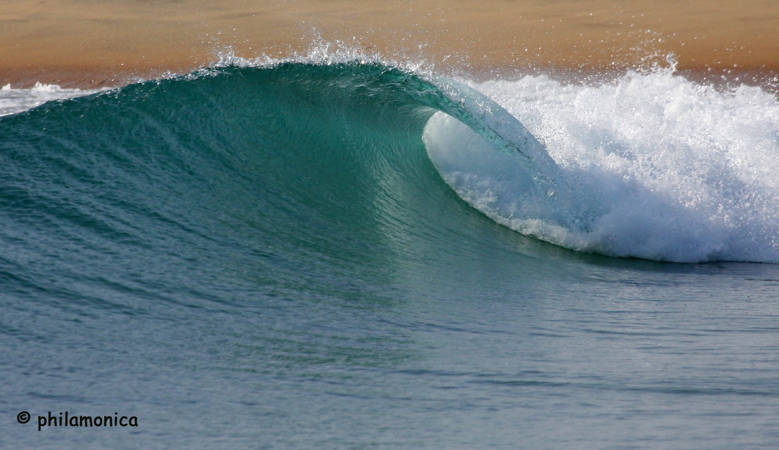
 Surf Forecast for Arugam Bay
TODAY’s Comments